Google's fleet of Street View vehicles have been flying around popular cities and tiny neighborhoods across the world for over a decade now, capturing photos of homes, parks, buildings and pretty much everything else you can see from the street. As its technology has advanced, Google has since retraced its steps, capturing higher quality images of the same places to make Google Maps even better.
In fact, if you go into Google Maps right now and use the Street View feature on your home, for example, you should see a pretty recent image, probably from the last year or so. However, that isn't the only image that exists of where you live. Google Maps stores every image taken of that location, dating back to 2007 -- you just need to know how to find them.
Interested in seeing what your home looked like over a decade ago? We'll show you how to use Google Map's time-travel feature on your phone and desktop.
While you're here, you should also check out how to use Google Maps even when you don't have internet and why you may want to blur your home from Google Maps.
How to see older Street View images on your phone
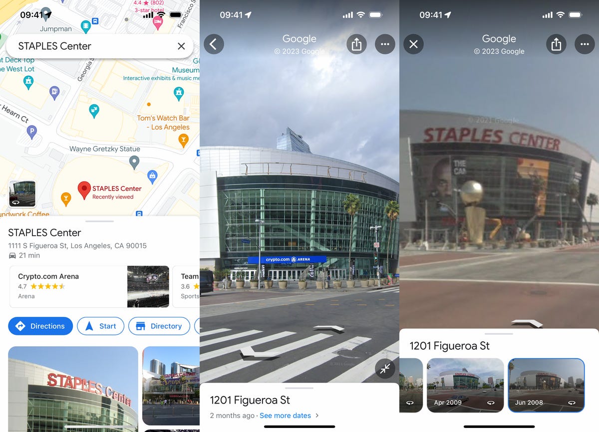
In the Google Maps app on iOS or Android, enter an address or place a marker down on a location for which you want to see photos.
Next, tap the Street View preview that appears right above the information window, which will take you into full-screen Street View mode. Then just tap the large map.
You should now see a blue See more dates option appear in the white window at the bottom of Street View. If you tap it, you'll see a carousel of images, each with a month and year describing when the photo was taken by Google. Swipe left and right to go through the various Street View images.

The renamed Crypto Arena in 2022 (middle) and then Staples Center in 2008.
Nelson Aguilar/CNETThe earlier the date, the lower the quality of the image you might see, but you should be able to see options as far back as 2007, with new images every few years or so. If you live in a major city, expect more Street View options.
Check out vintage Street View images on your computer
You can access the same Street View images from the past on your computer as well.
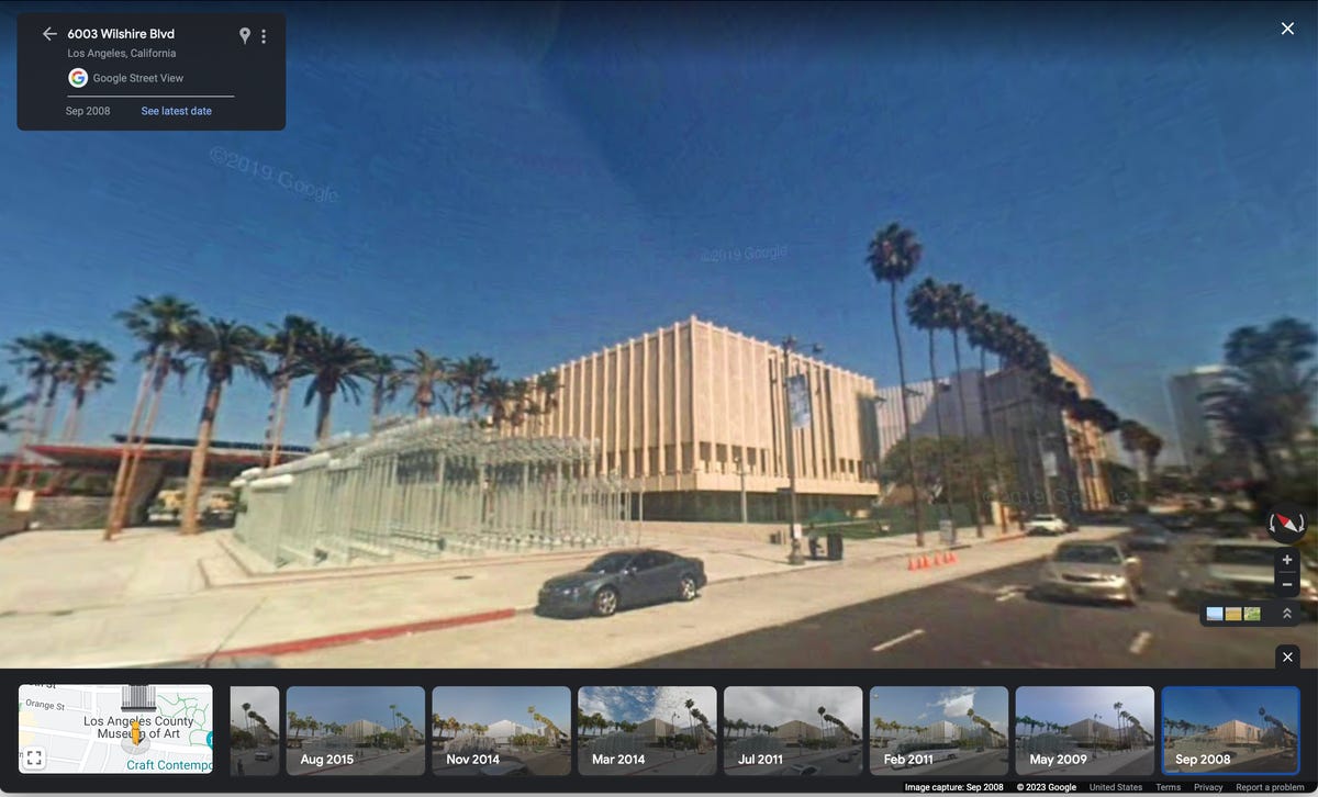
In the web browser of your choice, go to the Google Maps website and either enter an address or choose a point on the map. Once you have a location, click the photo that appears right above the address on the left side of Google Maps. If it's a Street View image, you'll be taken to Street View, but if it's not, find and click Street View & 360° and the image that appears underneath.
In Street View mode, you should see a gray transparent window on the top-left corner of the map. Click the See more dates option and a carousel of Street View images, from the last 15 years or so, will appear at the bottom. Use your mouse to click and drag through the various vintage photos.

The Los Angeles County Museum of Art in 2008.
Nelson Aguilar/CNETDone? Check out three new Google Maps features you'll definitely want to use and this Google Maps cheat sheet filled with all the most useful tricks.
Article From & Read More ( Discover the Past With This Hidden Google Maps Feature - CNET )https://ift.tt/nXbOB8R
Technology
No comments:
Post a Comment